Map. Web User
This section is designed to display the location of cameras on a map. Any user image can be used as a map, such as a floor plan, building layout, surrounding area, and so on.
When selecting the «Flat Maps» menu item, a table is displayed, showing:
Map name
Number of cameras on the map
Date of map creation
In this section, you can create and edit camera maps.
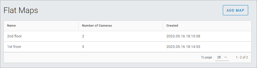
«Flat Maps» Menu
Section Pages: